Bitter Lake NWR--North Tract, West of Pecos River
Bitter Lake NWR--North Tract, West of Pecos River
Acme, New Mexico 88201
Bitter Lake National Wildlife Refuge Official WebsiteBitter Lake National Wildlife Refuge Important Bird Area webpage
Friends of Bitter Lake National Wildlife Refuge webpage
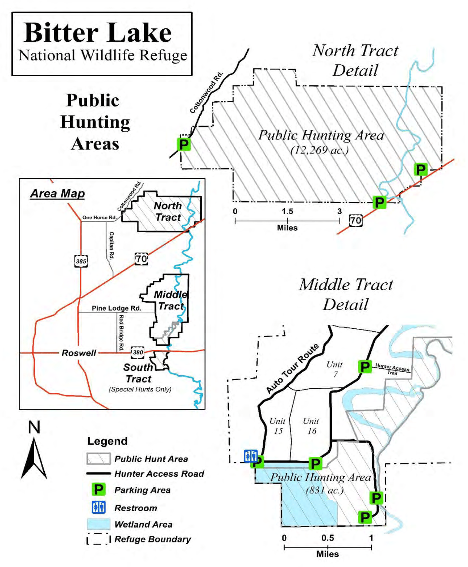
Bitter Lake National Wildlife Refuge map
Tips for Birding
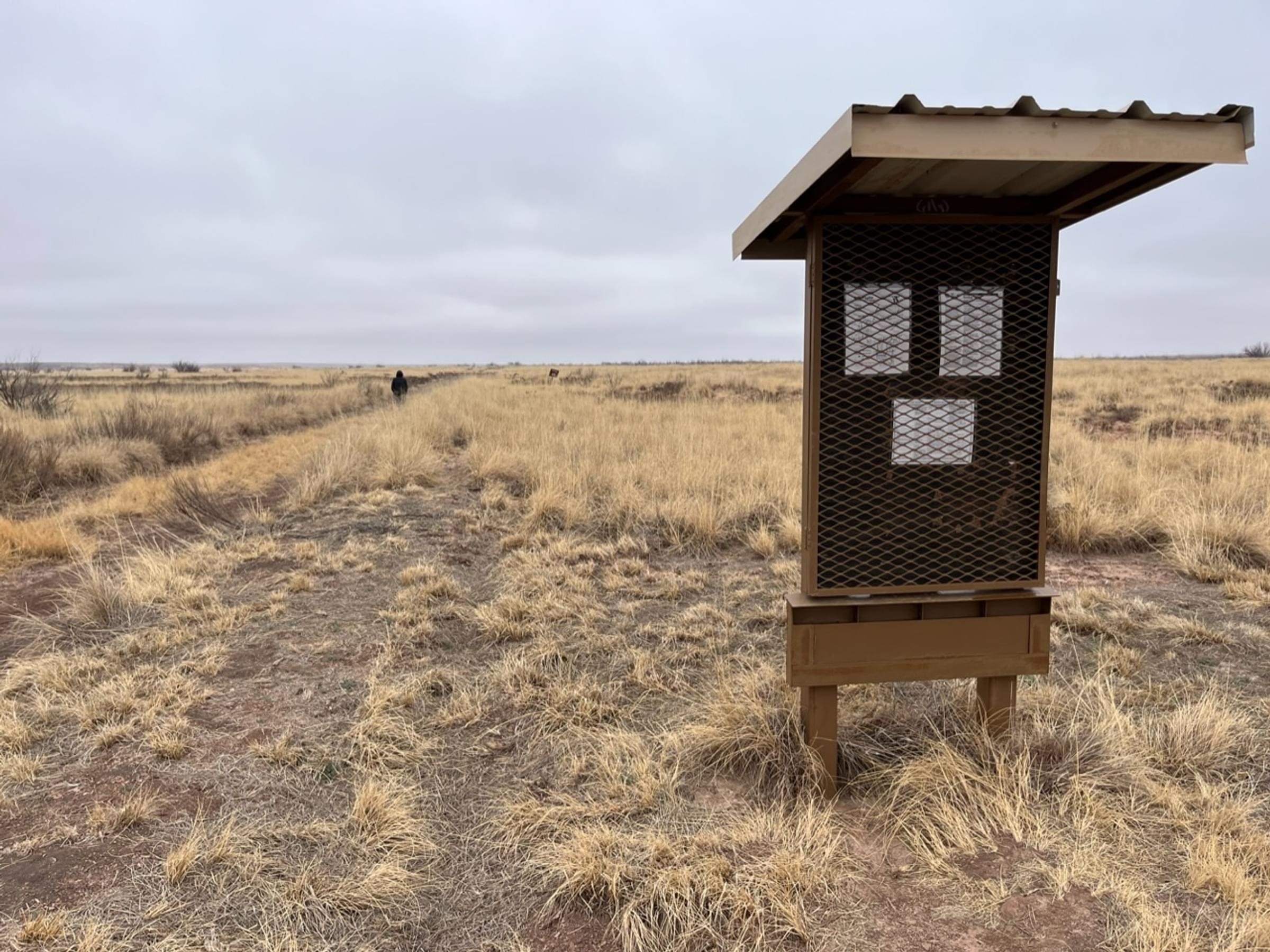
To access the hotspot from its southeast, park in the small dirt parking area on the north side of US-70 (approximately 10 miles from the intersection of US-70 with US-285). The parking area (shown most clearly on hunt maps and on the “Map” page of the Refuge website) is lower than the highway and can be muddy when the weather has been wet. If you step over the pipe opening in the barbed-wire fence on the west side of the parking area, there is a wide sandy path heading west along the southern boundary of the Salt Creek Wilderness. If instead you cross through the stile on the north side of the parking area and head toward the bulletin board, you’ll find a trail heading north in the non-wilderness portion of the hotspot. In less than half a mile, you reach a bow in the Pecos. The trail skirts the river for a fifth of a mile, continuing on its northern orientation, rather than following the Pecos northeastward the short ways to Salt Creek’s “confluence” with the river. This area offers some of the better birding in the hotspot. From the northern part of the bow to where the increasingly faint trail meets the Salt Creek arroyo is about three-quarters of a mile.
You may also access the hotspot on the west via County Road 15 (also known as One Horse Road), which heads east from US-285, seven and a half miles north of the intersection of US-285 and US-70, and County Road 26 (also known as Cottonwood Road). There are at least two pipe-framed gaps in the barbed-wire fence some yards to the east of the graveled road, but no improved parking areas. You’ll have to drive slowly as you approach the Salt Creek arroyo from the south (as well as a bit north of the arroyo) to spot the entrances. Once you’ve walked to either entrance, you will discover there is really not much of a trail.
Short-grass prairie and Chihuahuan Desert scrub are the dominant vegetation groups. Alkali sacaton, saltgrass, snakeweed, gypsum grama, sotol, and low-growing mesquite appear to be the most common plants, with salt cedar and phragmites on the banks of the Pecos. Salt cedar is also common along the Salt Creek arroyo. There are no large wetland areas in the North Tract as there are in the Middle Tract of the Refuge, so waterbird observations will be limited to the river and to flyovers. Many sinkholes with water lie north of the Salt Creek arroyo, but these are not favored by waterfowl.
The hotspot is very large, with the wilderness portion alone exceeding 9,600 acres. Noting in your “Checklist Comments” specifically where you birded would be helpful to others, or useful in reassigning your list later should the hotspot be divided.
Hunting is allowed in the hotspot area, and it is advisable to be aware of hunting seasons. Do not assume hunting days and times are the same as in the Middle Tract. Unfortunately, as New Mexico Game and Fish posts its calendar by species rather than by area (the hotspot being in Hunt Unit 32), a call to the Refuge may be required to find out if any hunting is occurring at the time of your visit.
There are no garbage cans, potable water, or toilets of any kind in the North Tract.
About this Location
This is one of two hotspots in the Refuge’s North Tract. The Pecos River runs north to south through the eastern portion of this tract, being joined by the ephemeral Salt Creek toward the tract’s southeast corner. The river courses thereby define 3 North Tract areas:
- east of the Pecos;
- west of the Pecos and south of Salt Creek; and
- west of the Pecos and north of Salt Creek.
The latter two areas, comprising this hotspot, are overlaid by an administrative differentiation, with all but a north-south strip along the west bank of the Pecos being wilderness. Other than official vehicles, no motorized vehicles are permitted in that strip. Of course, no vehicles of any kind, not even bicycles, are allowed in the wilderness.
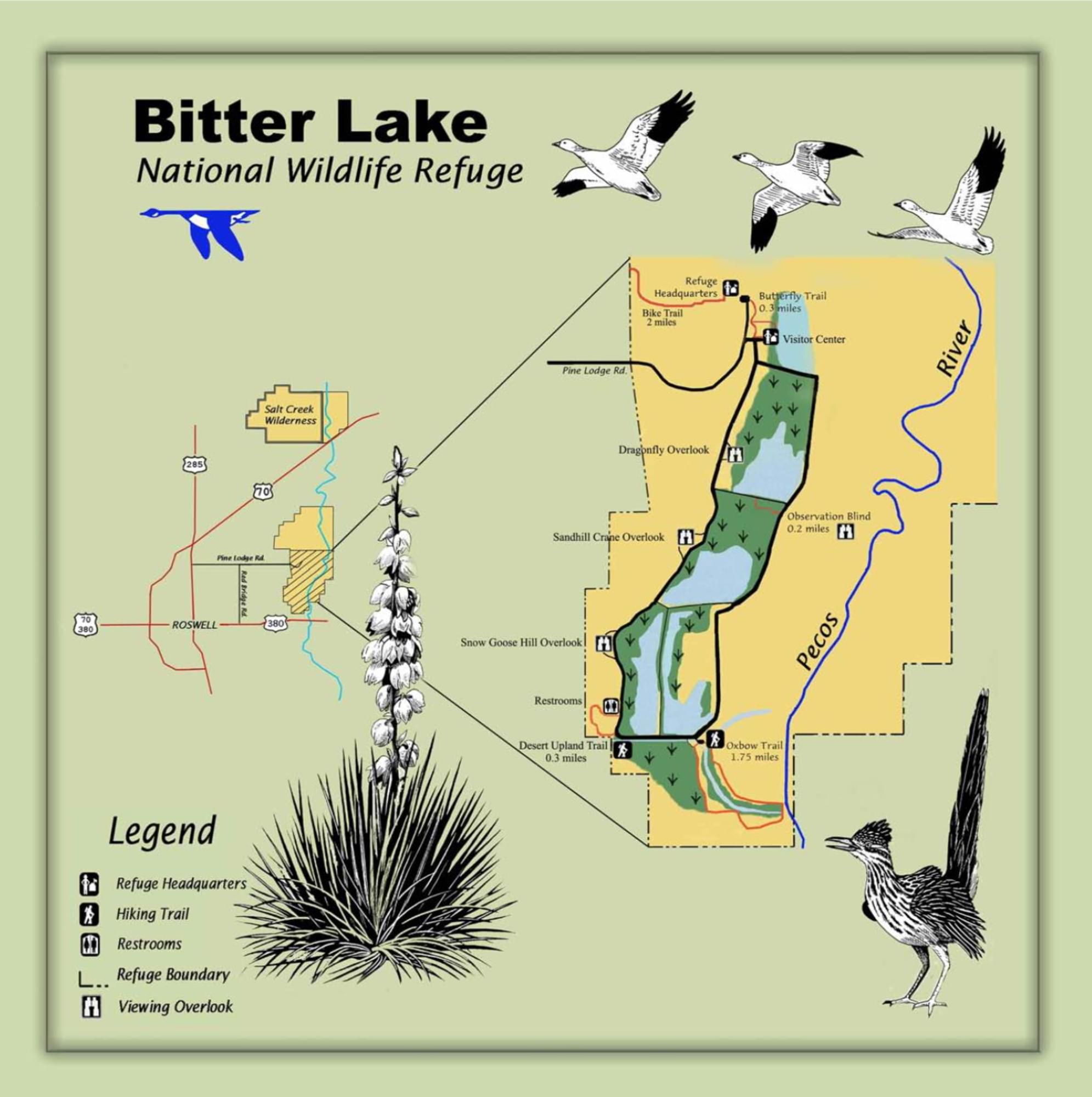
About Bitter Lake National Wildlife Refuge
See all hotspots at Bitter Lake National Wildlife Refuge
Bittle Lake National Wildlife Refuge has been designated as an Important Bird Area.
Bitter Lake National Wildlife Refuge protects and provides habitat for some of New Mexico’s most rare and unusual creatures such as the least shrew, Noel’s amphipod, least tern, Pecos sunflower, and Roswell spring snail.
Located where the Chihuahuan Desert meets the Southern Plains, Bitter Lake National Wildlife Refuge is one of the more biologically significant wetland areas of the Pecos River watershed system. Established in 1937 to provide wintering habitat for migratory birds, the refuge plays a crucial role in the conservation of wetlands in the desert Southwest.
Bitter Lake is an ecological crossroad where the Chihuahuan Desert meets short grass prairie, the Pecos River, and the Roswell artesian basin. The blending of these different ecological conditions has created some unusual biological conditions. Here you will find wetland-dependent species interacting with desert creatures.
The abundant water supply draws a documented 357 species of birds to the refuge. In addition 59 species of mammals, more than 50 species of reptiles and amphibians, 24 types of fish, and more than 100 species of dragonflies and damselflies are found in this oasis.
Features
Roadside viewing
Restrooms on site
Wheelchair accessible trail
Entrance fee
Content from Bitter Lake National Wildlife Refuge Official Website, John Montgomery, and John Montgomery
Last updated March 19, 2023