Berlin Lake--Mill Creek Recreation Area Campground
Berlin Lake--Mill Creek Recreation Area Campground
7400 Bedell Road Berlin Center, Ohio 44401
Official WebsiteBerlin Lake Official Website
US Army Corps of Engineers Water Management website
Berlin Lake map
Also, see all the hotspots at:
Berlin Lakes System Important Bird Area
Berlin Lake Birding Drive
About this Location
Mill Creek Day-Use Park is located on Berlin Lake in northeastern Ohio, where visitors enjoy boating, fishing, hunting, picnicking and camping.
A variety of recreational opportunities are available in the day-use area, the adjacent campground, and nearby wildlife areas.
Natural Features:
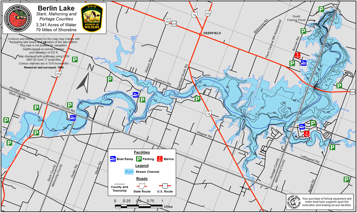
Berlin Lake is situated on the Mahoning River, where it covers 3,590 acres and offers 70 miles of shoreline. The banks of the lake are gently to moderately sloped, allowing for easy access. Beech and maple trees cover the area, offering shade and beautiful fall color.
A variety of wildlife makes its home around the lake. Visitors delight in viewing nesting ospreys. Bald eagles can occasionally be seen in the area as well.
Recreation:
The lake is a popular location for boating, swimming, and fishing. Berlin Lake is renowned for its excellent walleye fishing. It is one of the few area lakes where natural reproduction of the species occurs. Anglers will also find largemouth and smallmouth bass, muskie, crappie, and bluegill.
The Ohio Department of Natural Resources manages over 6,800 acres of project lands for public hunting and wildlife management purposes. Small game species are found in abundance and hunting areas can be easily accessed nearby.
About Berlin Lake
See all hotspots at Berlin Lake
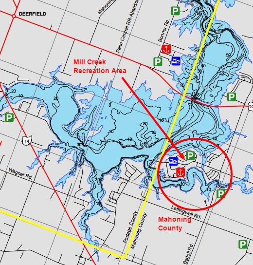
Berlin Lake spans three counties. The eastern portion is in Stark County, the middle portion is in Portage County, and the western portion is in Mahoning County. See the map for the county line boundaries.
Berlin Lake lies in the northeastern part of Ohio at the junction of Stark, Portage, and Mahoning counties. The lake is located on and is accessible from US-224 and OH-14 and OH-225. The U.S. Army Corps of Engineers constructed Berlin Lake in 1942 on the Mahoning River. The Congressionally authorized purposes were flood control, low flow augmentation, water quality control, and water supply. Berlin Lake has a mean depth of 23 feet with a maximum depth of 55 feet. Annual water level fluctuations can be as much as 20 feet. Mud, sand, and gravel make up most of the bottom composition. Rock ledges can be seen along the original river channel at low pool level.
Restroom facilities can be found at the headquarters building, the picnic area by the dam, and the Circle Restaurant in Deerfield.
Features
Restrooms on site
Wheelchair accessible trail
Entrance fee
Roadside viewing
Content from Official Website, Ohio Ornithological Society, and Susan Carpenter