Ales Run Wildlife Area
Ales Run Wildlife Area
Lower Salem, Ohio 45745
Official WebsiteAles Run Wildlife Area map
Also, see all the hotspots at:
Noble County Birding Drive
About this Location
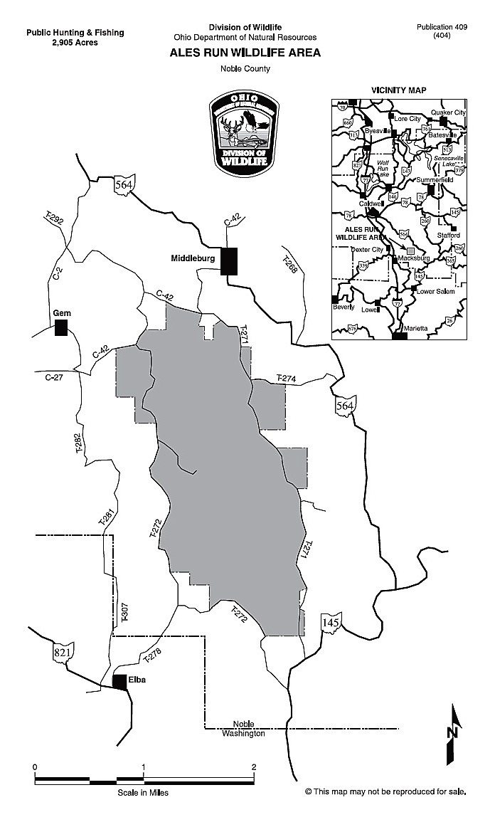
This 2,905-acre wildlife area is 3 miles east of Dexter City, traveling up County Road 2 to County Road 42 to gain access to the interior township roads. This area can be easily reached from I-77 or from OH-564 from Middleburg. Nearly 60 percent of Ales Run was strip-mined prior to modern reclamation laws (pre-1972). The resulting terrain is rugged and includes miles of high walls and many acres of spoil banks that have reverted to brushlands and small trees. The remaining 40 percent is undisturbed and is a mixture of woodland and brushland habitat. Within 5 miles of Ales Run is an additional 6,144 acres of the B&N Coal Inc. lands. A free permit is required to hunt B&N Coal, Inc. land.
B&N Coal, Inc. acquired the property during the 1950s and 1960s and coal mining was not completed until the 1970s. The coal was used primarily to fuel electric-producing utility companies in Ohio. In October 1987 an agreement was executed between B&N Coal, Inc. and the ODNR Division of Wildlife which enabled the Division of Wildlife to conduct wildlife management activities and permit free hunting, fishing, and trapping. The ODNR Division of Wildlife acquired this property from B&N Coal, Inc. in May 2000 and named it Ales Run. Hunting is the major recreational use and popular secondary uses include berry picking, mushroom hunting, bird watching, photography, and hiking.
Features
Restrooms on site
Content from Official Website