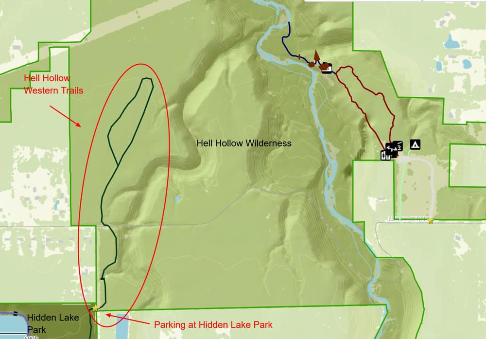
Hell Hollow Western Trails
Hell Hollow Western Trails
Leroy Center Road Painesville, Ohio 44077
Hell Hollow Wilderness Area Official WebsiteHell Hollow Wilderness Area map
Western Reserve Land Conservancy Parks and Preserves webpage
Also, see all the hotspots at:
Grand River-Lower Watershed Important Bird Area
About this Location
Parking for the Hell Hollow Wilderness western trails is at the intersection of Leroy Center Road and Kniffen Road in Hidden Lake MetroPark.
About Hell Hollow Wilderness Area
See all hotspots at Hell Hollow Wilderness Area
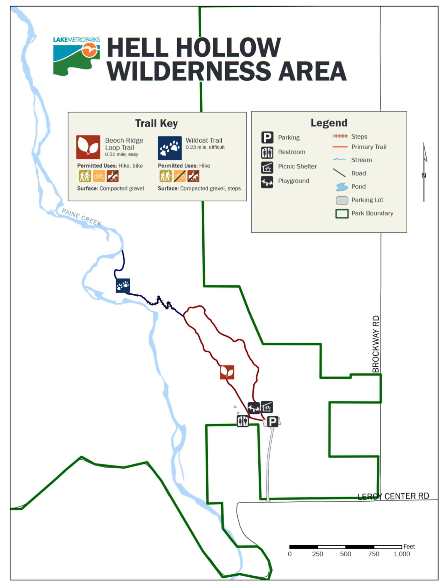
Hell Hollow Wilderness Area has a high cliff top with a loop trail and 262 timber steps that provide a dramatic descent to the creek valley. The more than 100-foot-deep ravine was carved thousands of years ago by Paine Creek after glaciers retreated from Ohio. This park offers impressive views of the 360-million-year-old Chagrin Shale cliff above a deep river valley.
Western Reserve Land Conservancy helped add 72 acres of upland and floodplain forest to the larger 981.5-acre Hell Hollow Wilderness Area. Lake Metropark’s Hell Hollow Wilderness Area has a high cliff top with a gravel loop trail and 262 timber steps that provide a dramatic descent to the Paine Creek valley. This park offers impressive views of the 360-million-year-old Chagrin Shale cliff above a deep river valley. Another gravel loop trail extends into the wilderness area from Hidden Lake Park located to the southwest. Visitors can enjoy hiking, biking, birdwatching, and picnicking. The picnic area also includes a restroom and playground.
Features
Restrooms on site
Wheelchair accessible trail
Entrance fee
Roadside viewing
Content from Hell Hollow Wilderness Area Official Website and Western Reserve Land Conservancy Parks and Preserves webpage