Berlin Lake Bike Trail
Berlin Lake Bike Trail
Deerfield, Ohio 44411
Official WebsiteBerlin Lake Bike Trail map
Berlin Lake Official Website
US Army Corps of Engineers Water Management website
Berlin Lake map
Also, see all the hotspots at:
Berlin Lakes System Important Bird Area
Berlin Lake Birding Drive
About this Location
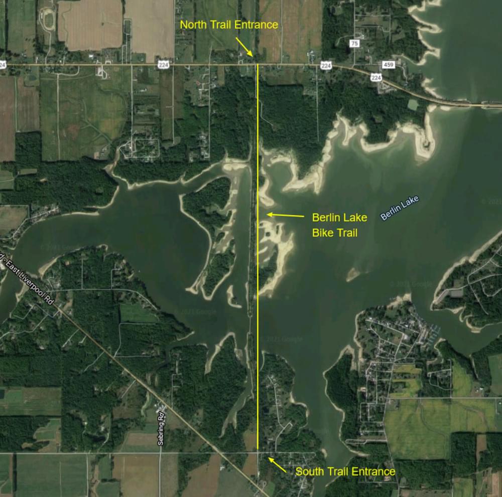
This 2.2-mile limestone-paved trail was built on the former Lake Erie, Alliance, and Wheeling Railroad, constructed between 1875 and 1877. Ownership changed to New York Central RR then Penn Central RR. The bridge was rebuilt in 1942 with the construction of the Berlin Reservoir damming the Mahoning River. The railroad was abandoned between 1972 and 1976.
- Two trailhead parking areas: 10-car asphalt lot on US-224; 10-car limestone lot on Kirkbride Road.
- Information kiosks
- Mile markers
- Benches
- Multipurpose limestone trail
- Nearby Berlin Lake Recreation Area and Wildlife Areas for camping, hunting, and fishing
Trail development was made possible thanks to a variety of individual and organization donations, fundraising by the Berlin Lake Association, boy scouts, volunteers, state grants, and the cooperation of Deerfield Township, ODOT, US Army Corps of Engineers, and ODNR.
The Berlin Lake Trail was initiated by the Berlin Lake Association back in 2006 when members with a vision for the future approached the Portage Park District to partner in its development. The Park District was granted a sublease on the trail from the Ohio Division of Wildlife, which leases the land from the US Army Corps of Engineers. The trail opened in the fall of 2011.
Restroom facilities on Berlin Lake can be found at the headquarters building, the picnic area by the dam, and the Circle Restaurant in Deerfield.
About Berlin Lake
See all hotspots at Berlin Lake
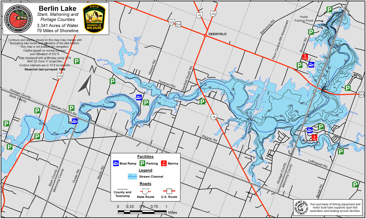
Berlin Lake spans three counties. The eastern portion is in Stark County, the middle portion is in Portage County, and the western portion is in Mahoning County. See the map for the county line boundaries.
Berlin Lake lies in the northeastern part of Ohio at the junction of Stark, Portage, and Mahoning counties. The lake is located on and is accessible from US-224 and OH-14 and OH-225. The U.S. Army Corps of Engineers constructed Berlin Lake in 1942 on the Mahoning River. The Congressionally authorized purposes were flood control, low flow augmentation, water quality control, and water supply. Berlin Lake has a mean depth of 23 feet with a maximum depth of 55 feet. Annual water level fluctuations can be as much as 20 feet. Mud, sand, and gravel make up most of the bottom composition. Rock ledges can be seen along the original river channel at low pool level.
Restroom facilities can be found at the headquarters building, the picnic area by the dam, and the Circle Restaurant in Deerfield.
Notable Trails
The Berlin Lake Trail is a 2.2 multipurpose trail crossing Berlin Lake.
Parking is available at the north trail entrance on US-224, approximately 1.5 miles east of Deerfield Circle. Parking for the south trail entrance is located on Kirkbride Rd. off of OH-14, approximately 2 miles southeast of Deerfield Circle. Turn left on Kirkbride Road.
Features
Wheelchair accessible trail
Restrooms on site
Entrance fee
Roadside viewing
Content from Official Website, Ohio Ornithological Society, and Susan Carpenter