Killdeer Plains Wildlife Area--Harold Roe Wetland
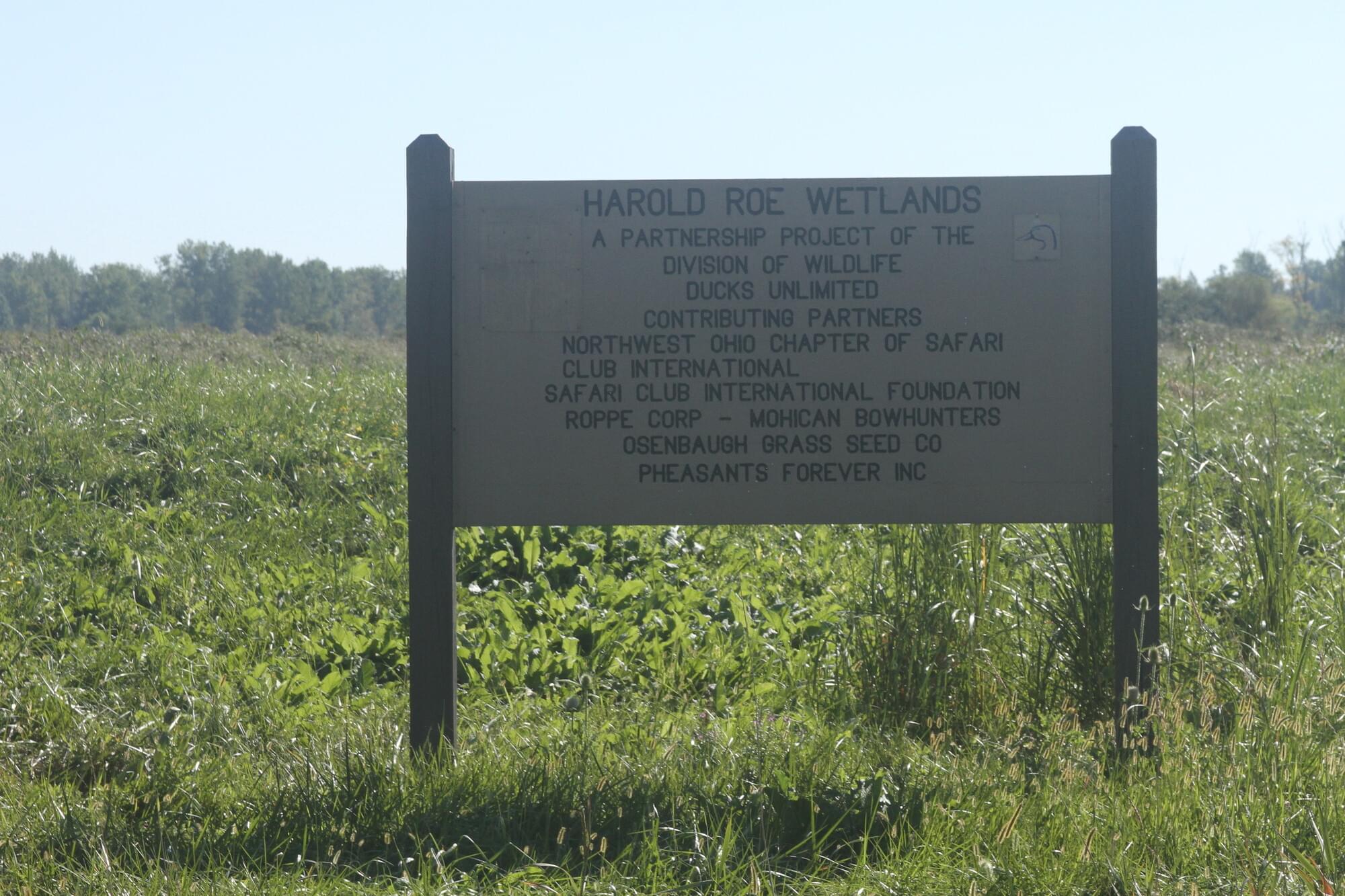
Killdeer Plains Wildlife Area--Harold Roe Wetland
Upper Sandusky, Ohio 43351
Killdeer Plains Wildlife Area Official WebsiteKilldeer Plains Wildlife Area map
Also, see all the hotspots at:
Killdeer Plains-Big Island Important Bird Area
Killdeer Plains Birding Drive
About this Location
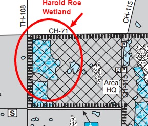
View Harold Roe Wetland from the roadside only. The best views are from Township Highway 108. This road is less busy than County Highway 71. Watch for ducks and geese during migration and Bald Eagles may be in this area in any season.
Certain parts of Killdeer Plains Wildlife Area in Wyandot County are off limits to the public. While much of this heavily birded 9,000+ acre wildlife area has no restrictions on access, the area bounded by County Highway 68 and 75 on the south, County Highway 71 on the north, Township Highway 108 on the west, and County Highway 119 on the east are off limits. There are signs that clearly mark these boundaries. Please, see Killdeer Plains Wildlife Area map.
For the most part, the refuge area of Killdeer Plains encompasses the vicinity of Pond 27 and the other large ponds at the east end of the wildlife area. Very good viewing opportunities can be had from along County Highway 68 on the south side of the large ponds.
About Killdeer Plains Wildlife Area
See all hotspots at Killdeer Plains Wildlife Area
The 9,230-acre Killdeer Plains Wildlife Area lies in the grain farming country of north-central Ohio, eight miles south of Upper Sandusky. Wyandot County Road 115 provides access from OH-294, two miles west of Harpster, and from OH-309, eight miles west of Marion. OH-67 and OH-294 border the area on the west and north. Killdeer Plains Wildlife Area is quite flat, with little natural drainage; however, land adjacent to the Little Sandusky River on the east edge of the area is quite rolling.
Approximately two-thirds of the area is in cropland and grassland. The other one-third is divided almost equally between woods and shrubby coverts and water. The water areas include more than 1,000 acres of marsh, a 360-acre green tree reservoir, and 125 ponds ranging from less than an acre to 50 acres in size. Most small ponds are not shown on the map.
Killdeer Plains Wildlife Area is situated in a natural basin of flat, poorly drained soils formerly covered by prairie sloughs. The original prairie spanned about 30,000 acres. Early records report an abundance of deer, waterfowl, and furbearers. The “Plains” eventually were drained, with varying degrees of success, by ditching and tiling. Today, the agricultural land around the area is intensively farmed for corn and soybeans. The purchase of land for this area began in 1952.
Wildlife management activities included the development and management of several thousand acres of grain crops and grassland, primarily for nesting and migrating grassland wildlife. Trees and shrubs have been planted along field borders and in odd areas to provide permanent cover for upland wildlife. Woods have been protected and improved. Several of the ponds provide fishing opportunities. An 800-acre marsh was constructed in 1966. All suitable fishing waters were stocked with fish. Waterfowl production was enhanced through the provision of several hundred wood duck nest boxes and Canada goose nesting structures. The green tree reservoir was completed in 1994 with assistance from Ducks Unlimited. Pond 3 has been converted to a moist soil unit for the benefit of waterfowl.
The primary purpose of the wildlife area is for grassland wildlife management and associated recreational use. Uses that have become increasingly popular because of the area’s natural features and open character are nature lore, wildlife photography, and bird watching.
Restroom, portable toilet, at Wildlife Area Headquarters.
Accessible Electric APV Trail on former County Road 75, permit required. This road is closed to other vehicles.
Features
Roadside viewing
Restrooms on site
Wheelchair accessible trail
Entrance fee
Content from Ohio Ornithological Society, Ohio Division of Wildlife, and Killdeer Plains Wildlife Area webpage
Last updated February 7, 2024