Tinkers Creek SP
Tinkers Creek SP
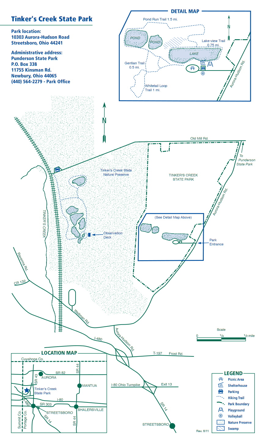
10303 Aurora Hudson Road Streetsboro, Ohio 44241
Official WebsiteTinkers Creek State Park map
About this Location
The majority of Tinker’s Creek State Park is maintained in its original state as a swamp and marshland. These wetlands owe their existence to the glaciers that invaded Ohio during the Pleistocene Ice Age. Glacial features include moraines, kames, and eskers. Moraines were formed when a glacier remained stationary for a long period of time leaving hills of boulders, sand, and gravel. Kames are deposits of sand and gravel that fell through holes in the ice leaving circular hills. Eskers are deposits of sand and gravel that dropped through ice tunnels leaving long serpentine mounds. Many fine examples of these glacial features are found in the region.
This part of Ohio is known for the number of naturally occurring lakes. Huge blocks of ice broke free from the glaciers creating depressions that filled as the ice blocks melted. These are known as kettle lakes. Over the ensuing 10,000 years, these lakes have partially filled with sediment leaving boggy wetlands with unique assemblages of plants. Buttonbush, alder, and swamp white oak predominate.
During the spring and fall migration periods, the marsh provides food and shelter for thousands of waterfowl. Mallards, wood ducks, and Canada geese nest in the marshlands each year. In addition, woodcock, rail, gallinule, snipe, heron, and bittern are often sighted. Beaver and muskrat are common residents.
Tinkers Creek State Nature Preserve borders the west side of the state park. There is a separate parking lot for the nature preserve on the north side of Old Mill Road.
Notable Trails
Tinkers Creek State Park Trails
Much of Tinkers Creek State Nature Preserve within the State Park is inaccessible to pedestrian traffic because of wet and swampy conditions. However, visitors can enjoy the 0.5-mile trail which circles through the Seven Ponds region of the preserve. This trail, traversing open field areas as well as hardwood and evergreen stands, provides a closer look at the vast marsh surrounding the much smaller upland trail area. This is an excellent spot for birding. Geese and herons usually can be spotted along this section of the trail.
The South Point Trail extends southward through a dense stand of oaks, beeches, and maples to the tip of the upland peninsula. From South Point, visitors can see the beaver ponds and marsh to the south and west. The trees and shrubs in this area flash with the colors of wood warblers in mid-May.
Lonesome Pond Loop is a short trail around an isolated spring-fed lake. The work of beavers is readily apparent all around Lonesome Pond, from the lodge on the south bank, to the cut and stripped saplings below the banks of the pond. The trails are seasonally wet and mosquitoes and deer flies can be pests in the summertime. Wear sturdy hiking shoes, appropriate seasonal clothing, and insect repellent in summer.
Features
Restrooms on site
Wheelchair accessible trail
Entrance fee
Roadside viewing
Content from Official Website