Riverwalk Park
Riverwalk Park
Waltham, Massachusetts 02453
Riverwalk Park mapCharles River Bike Path Official Website
Charles River Bike Path map
About this Location
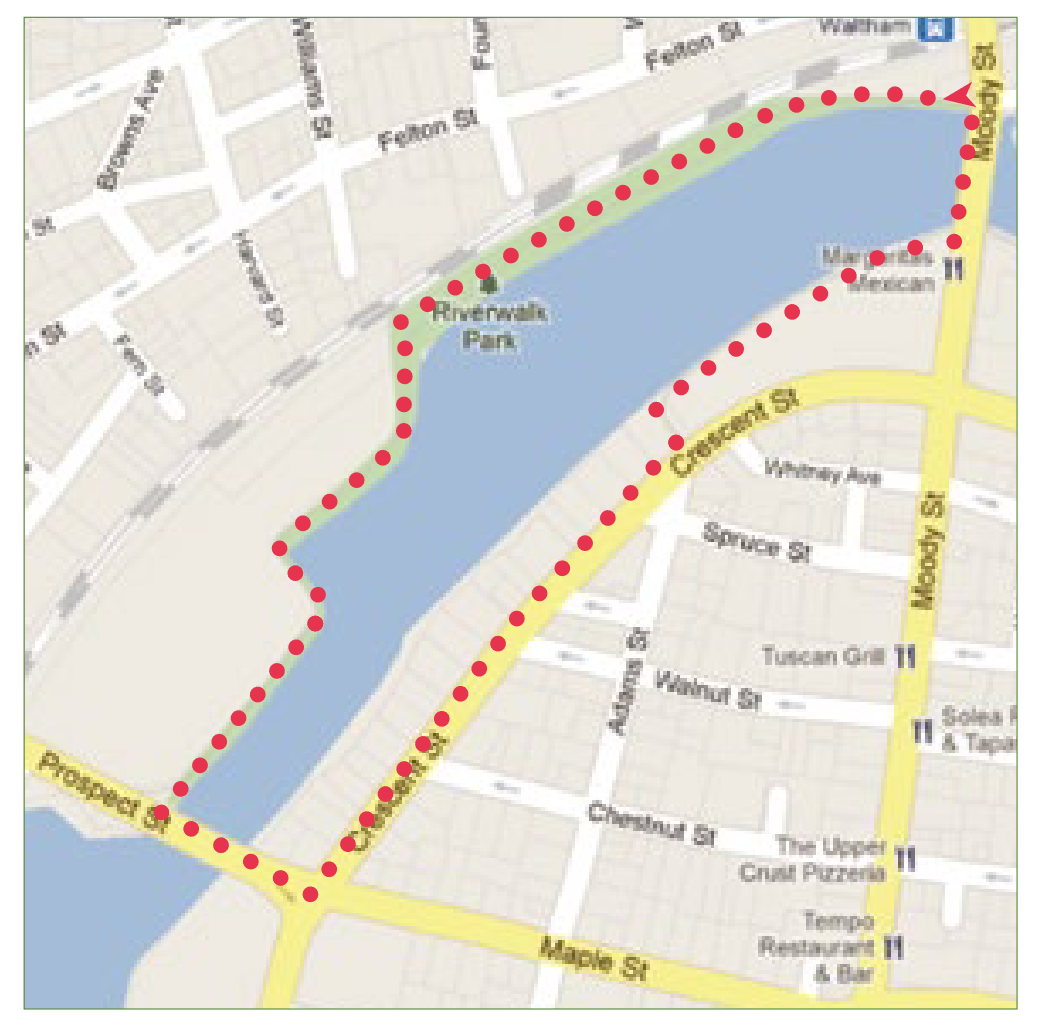
The walk at Riverwalk Park starts on the north side of the Moody Street Bridge where the Charles River Reservation path is marked by two granite pillars. Walk upstream along the paved pathway then cross over the river using the Prospect Street Bridge. Turn left and continue on Crescent Street, heading left onto the Riverwalk along Cronin’s Landing Condominiums back to Moody Street.
About Charles River Bike Path
See all hotspots at Charles River Bike Path
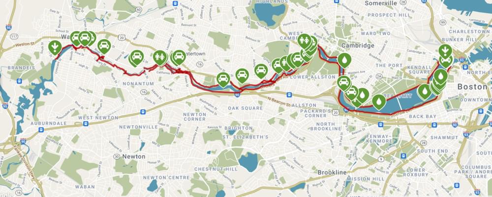
The Charles River Bike Path also referred to as the Charles River Greenway, offers a paved, 22-mile route from Boston to its western suburbs. The trail is also part of a larger, developing network called the East Coast Greenway, which stretches from Maine to Florida.
A large section of the trail, beginning on its eastern end and extending 16 miles, is named after Dr. Paul Dudley White, a prominent cardiologist and proponent of preventative medicine such as exercise. This Dr. Paul Dudley White Bike Path hugs each side of the Charles River through Boston, Cambridge, and Watertown.
In many sections of the route, there are multiple parallel trail options for those who prefer an unpaved surface or would like to stay further from the road activity. Several architecturally interesting bridges will greet you as you enter Cambridge from Boston, allowing you to create shorter routes on both sides of the river as opposed to the larger loop. While busy roads parallel the trail on both sides of the river, most of the route has trees and green space along the way. Along the way, you can enjoy watching boats skim by and even try your hand at a variety of water sports that are available to the public at numerous locations.
Notable Trails
The Waltham City Walks brochure has a description and map of a hike at Riverwalk Park.
Features
Wheelchair accessible trail
Restrooms on site
Entrance fee
Content from Charles River Bike Path Official Website
Last updated January 7, 2024