Middle Branch Trail--Saratoga Hills
Middle Branch Trail--Saratoga Hills
Saratoga Hills Street Northeast Canton, Ohi9o 44721
Middle Branch Trail mapSaratoga Hills map
Middle Branch Trail Official Website
Middle Branch Trail map
About this Location
Turn from Boettler Avenue onto Saratoga Hills. At the first curve leave the road and continue straight on the drive towards a gate. Park on either side of the drive. As one drives toward the gate, there is ample parking on either side of the drive. Nose in parking would allow for more cars, but most simply parallel park on both sides.
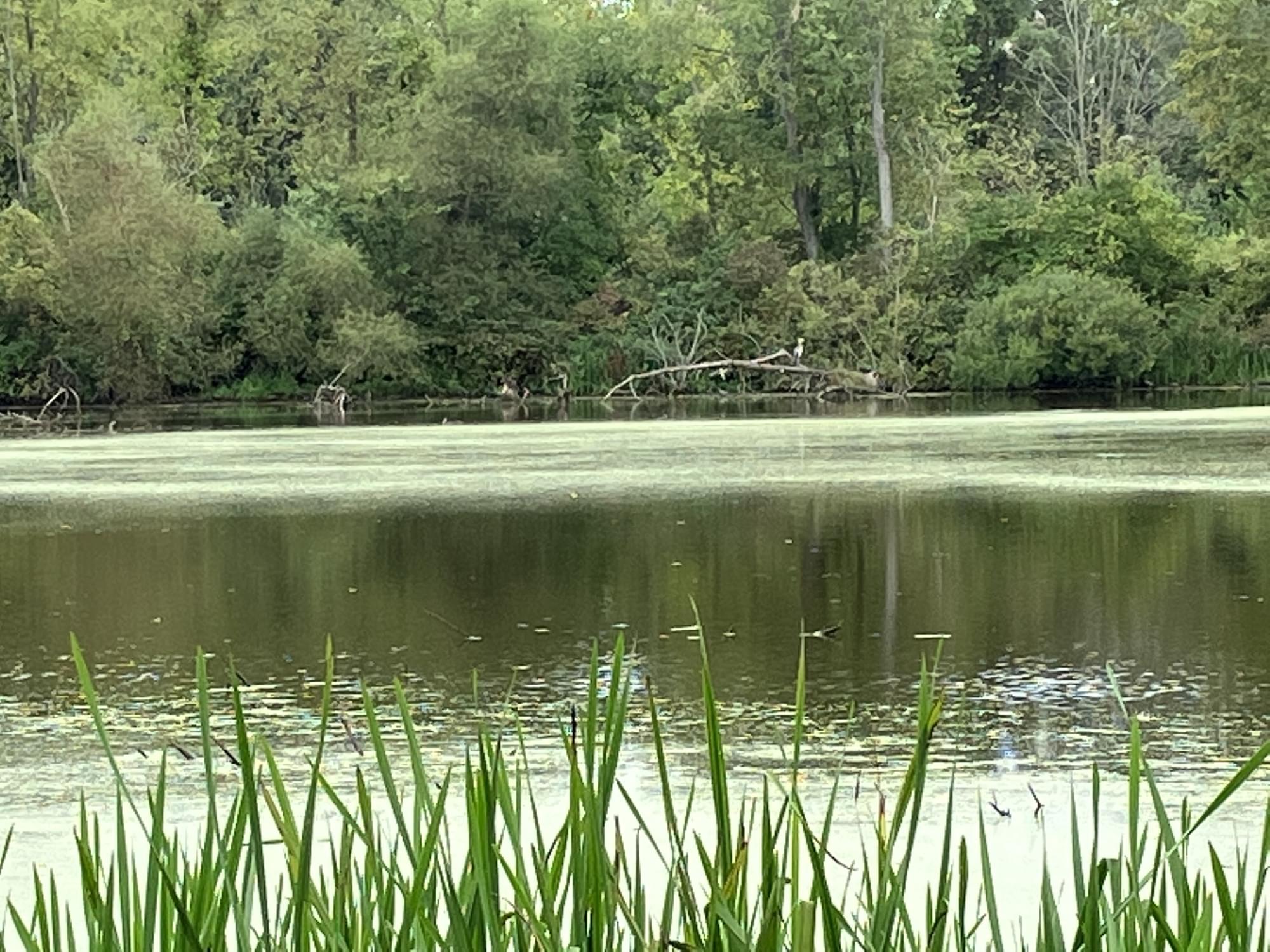
There is a loop of the trail around a pond. This section of the trails is a stand of mixed deciduous trees bordered on one side by a housing development. The other side is an open field, clearly in succession with the few saplings and low growth overtaking the grasses. A small field margin habitat, but a wealth of birds.
An extension of the Middle Branch Trail is under development in the Saratoga Hills housing complex.
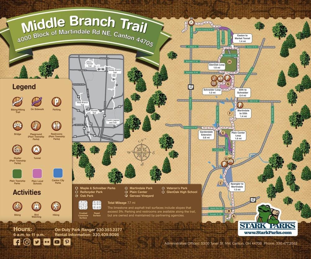
About Middle Branch Trail
See all hotspots at Middle Branch Trail
The Middle Branch Trail is maintained by Stark Parks and connects Canton City Parks including Robert E. Schreiber Park, Reifsnyder Park, Oak Park, and Martindale Park. The trail continues north along the railroad tracks then meanders through Gervasi Vineyard and past Rice’s Nursery. The trail then loops around Plain Township’s Veterans Community Park, continues north across Schneider Street, and loops around Glenoak High School.
A 1.31-mile on-road connection to the Hoover Trail through Lexington Farms on Easton Street uses the sidewalk parallel to Rosedown Boulevard before heading west on Stone Crossing Street, south on Marelis Avenue, and west on Bellview Street to Market Avenue.
Parking and restrooms are available along the trail but are owned and maintained by partnering agencies.
Features
Restrooms on site
Content from Middle Branch Trail Official Website and Barbra Lewis