Portage Hike and Bike Trail--Crain Ave. Bridge
Portage Hike and Bike Trail--Crain Ave. Bridge
Lake Street Kent, Ohio 44240
Portage Hike and Bike Trail Official WebsitePortage Hike and Bike Trail map
Tips for Birding
Standing on the Hike and Bike Trail bridge offers good views of the Cuyahoga River below, and the area beneath the Fairchild Avenue Bridge. The air space above the slow-moving water under the Fairchild Avenue Bridge seems to attract foraging swallows. Walking adjacent sections of the trail provides good views of the river's edges and vegetation. There are some patches of wildflower growth around the newly opened North Water Brewing Company building.
Birds of Interest
Swallows, sometimes in high numbers, fly over the Cuyahoga River, around and under the two bridges, during the spring and summer months.
About this Location
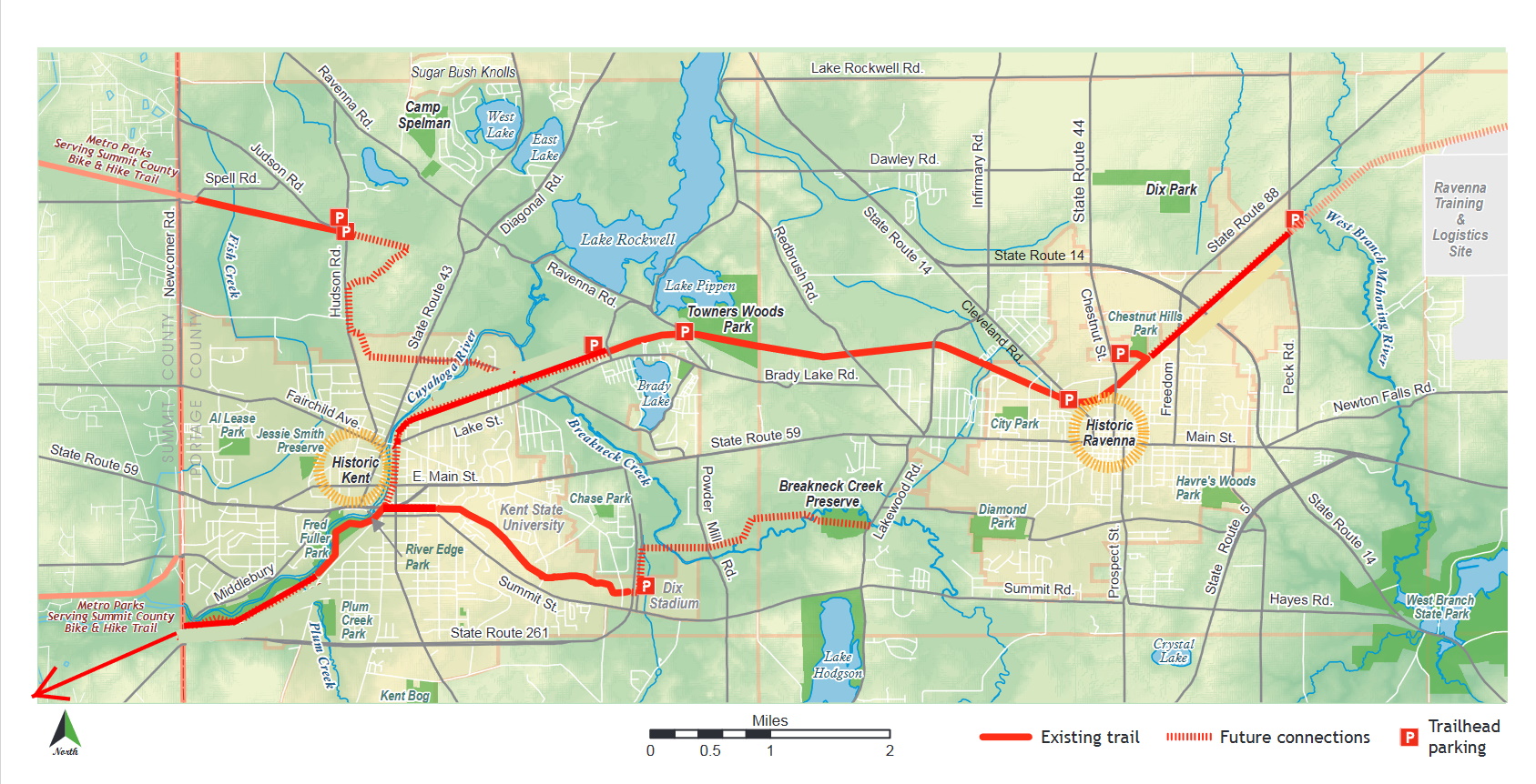
The Portage Hike and Bike Trail crosses the Cuyahoga River on its own bridge just north of the Fairchild Avenue Bridge near the junction of Crain Avenue, Lake Street, and Water Street.
About Portage Hike and Bike Trail
See all hotspots at Portage Hike and Bike Trail
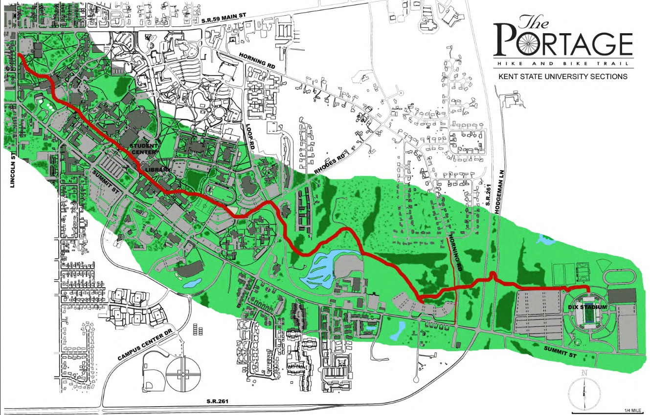
The Portage Hike and Bike Trail is a multi-jurisdictional project, with portions of the trail managed by Portage Park District, the City of Kent, City of Ravenna and Kent State University.
- Multiple trailheads and parking areas
- Information kiosks
- Interpretive signs
- Picnic tables
- Multipurpose trail including both asphalt and limestone sections
The Portage Hike and Bike Trail serves as a key east-west link between the major trail systems in Northeast Ohio. It was developed through a partnership between Portage Park District, Portage County, Wheeling & Lake Erie Railroad, City of Kent, Kent State University, Franklin and Ravenna Townships, and the city of Ravenna. Direct and indirect connections to adjacent regional trails, such as Metroparks, Serving Summit County’s Bike and Hike Trail, encourage a variety of short and long trail rides to local neighborhoods and towns to Cleveland, Akron. and the Cuyahoga Valley Towpath Trail.
Historically used as a transportation route by Native Americans, with Standing Rock nearby, the Portage Hike and Bike Trail is also located along the historic Erie rail line, with a portion of it running alongside a still-active railroad operated by the Akron Barberton Cluster Railway. Portions of the trail travel along the Cuyahoga River, remnants of the P&O Canal, the historic Kent Railyards, Towner’s Woods, and Chestnut Hills Park. The Portage Hike and Bike Trail now connects schools, businesses, and parks with downtowns and neighborhoods from Ravenna to Kent and beyond.
Parking for Park District-managed sections in the townships is available at:
+ Lake Rockwell Road, Franklin Township
+ Towner’s Woods, Franklin Township
+ Cleveland Road in Ravenna
+ Hudson Road and Judson Road in Franklin Township for the Franklin Connector section.
Features
Wheelchair accessible trail
Restrooms on site
Entrance fee
Roadside viewing
Content from Portage Hike and Bike Trail Official Website and Alex Colucci
Last updated April 15, 2023