Patch Hill Conservation Land
Patch Hill Conservation Land
Boxborough, Massachusetts 01719
Official WebsitePatch Hill Conservation Land brochure and map
About this Location
Patch Hill Conservation Area is the largest conservation parcel owned by the Town of Boxborough. Patch Hill Conservation Area also likely ranks highest for wildlife habitat and overall bio-diversity, supporting numerous vernal pools, rare species, and several types of forest communities, and protecting the headwaters of Guggins Brook. Patch Hill itself, also known as Goat Hill, is a glacial drumlin, the summit of which is either the second or third highest point in Boxborough, depending on the source of information consulted.
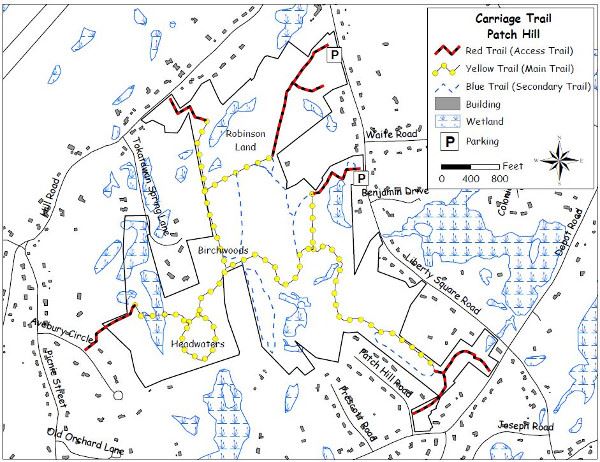
There are three parking areas. One is located on Liberty Square Road midway between Waite Road and Benjamin Drive, on the opposite side of the road from the latter two. The second is located on Hill Road approximately two-tenths of a mile beyond Tokatawan Spring Lane in the direction of the Boxborough-Littleton town line. The third is at Liberty Fields, however, the Recreation Commission requests that the Liberty Fields parking area not be used for access to conservation land during major sporting events.
There are several miles of trails within the preserve, all of which are marked and easily accessible. Hikers can travel between widely spaced trailheads on Depot Road, Liberty Square Road, Avebury Circle, Hill Road, and Tokatwan Spring Lane. All trailheads are identified with signs.
Notable Trails
The AllTrails website has a description and map of a hike at Patch Hill Conservation Land.
Features
Restrooms on site
Wheelchair accessible trail
Entrance fee
Content from Official Website
Last updated January 7, 2024