Wilson Canyon Trail
Wilson Canyon Trail
Coconino National Forest Sedona, Arizona 86336
Official WebsiteWilson Canyon Trail map
About this Location
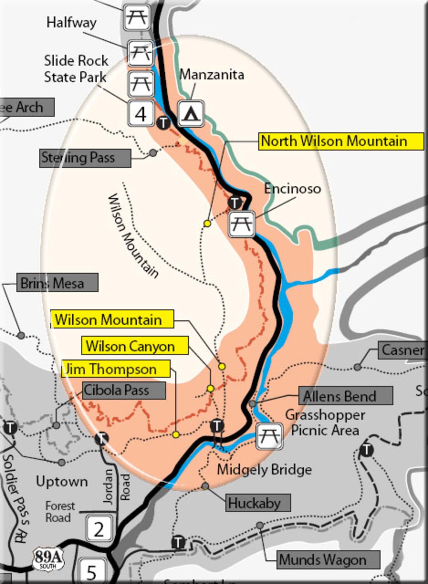
This trail begins at the picnic ramada just up the old roadway from the Midgley Bridge parking area.
Hiking Time: Allow 2.5 hours roundtrip.
Notable Trails
At .1 miles, bear right onto the trail marked by large rock cairns. It gradually climbs, then descends to the normally dry canyon drainage. At .6 miles, past the fork to the right signed for the Wilson Mountain Trail, and then the fork to the left signed for the Jim Thompson Trail. Continue ahead, entering the Wilderness area in the partial shade of live shrub oak and small Arizona cypress.
Views are now limited to the tops of the canyon walls and the upper portion of Wilson Mountain ahead. Nearing 1.5 miles, the trail enters the drainage and proceeds over red rock with an occasional rock scramble in the shade of large Arizona cypress. At 1.5 miles, there is a red rock outcrop on the right. A side path climbs this and continues a short way, ascending about 100 feet to a saddle offering excellent views. This is a good place to turn around and return by the same route for a 3-mile roundtrip hike.
The AllTrails website has a description and map of a hike on the Wilson Canyon Trail.
Content from Official Website