
Big Walnut Trail
About this Location
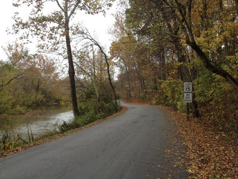
The Big Walnut Trails follows the Big Walnut Creek from Hoover Reservoir to Inniswoods Metro Gardens, running through various beautiful parks along the way. Several segments also pass by Creekside in Gahanna and the southeast area of Columbus.
Communities: Columbus, Gahanna, Westerville
Points of Interest
- Hoover Reservoir
- Gahanna Creekside Park
- Inniswood Metro Park
- Elk Run Park
Notable Trails
Big Walnut Trail – Granville Street to Galloway Preserve
The best places to access this part of the trail are from either end; either park at Veterans Memorial Park (off East Johnstown Road) at the north end or along Cliffside Drive at the south end. South of Granville Street, the Big Walnut Trail squeezes between the Gahanna Swim Club and Big Walnut Creek before looping through Price Road Park. This large park is mostly successional fields and attracts many species uncommon elsewhere in the vicinity, like Woodcocks, Brown Thrashers, Field Sparrows, and Common Yellowthroats. A series of footpaths head west from the bike path, allowing further exploration of the park habitat.
At the southern end of the park, the trail makes an intersection, with the south and west forks going to Price Road, while the east fork crosses over the creek to run along the north end of Galloway Preserve before dumping out at Cliffview Drive. The more forested patches in this preserve act as a sound buffer for nearby I-270, but also have a decent diversity of forest birds. Often birds migrating down the Big Walnut corridor will pile up at this southern end, reluctant to cross the freeway and airport further south, so the area can have flocks of Robins, waxwings, blackbirds, and sparrows.
Big Walnut Trail – Gahanna Creekside Park
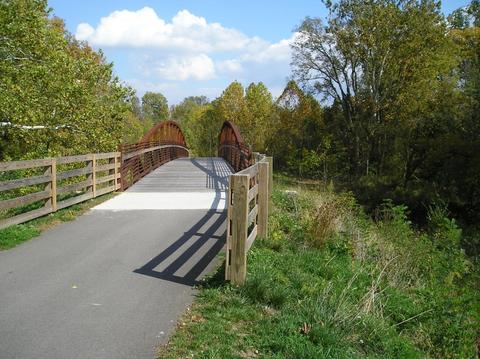
Just north of Granville Street is a creekside park complex; park for it at either the Golf Course lot along Olde Ridenour Road or off Mill Street. in downtown Old Gahanna. The main bike path winds along the creek, past a footbridge and north to the golf course clubhouse, before bending north to join Olde Ridenour Road. The best birding is off the main path. On the east side is Bauer Island, accessed by a footbridge, which has forest birds as well as a resident flock of Mallards sometimes joined by rarer water birds. On the west side is a boardwalk loop around an old oxbow of Big Walnut Creek, which has both swampy and marshy areas. This can be a great spot for unusual birds in migration and has had irregularly resident Screech Owls in the past.
Big Walnut Trail – Olde Ridenour Road
North of Granville Street, the bike path crosses Creekside Park (a separate hotspot) before bending west to join Olde Ridenour Road. This scenic road borders the golf course for a half mile before cutting through McCorkle Park and winding over a forested creek side bluff, then dropping into the narrow floodplain along Big Walnut Creek before finally emptying out onto Carlin Court. The mix of habitats here not only makes for a beautiful drive but also for good birding. You can park at the golf course for the lower part, at McCorkle Park in the middle, or along Carlin Court for the upper part.
The lower part with the open fields of the Golf Course often has small flocks of geese and mallards, as well as flocks of Robins with the occasional bluebird. McCorkle Park has a wooded bluff on the west and a soccer field surrounded by shrub swamp on the east and birding the margins here can turn up a wide variety of birds. If you walk the road further north from here, you can often get a diversity of forest birds as the road goes over the bluff, then down into the floodplain. Yellow-throated Warblers breed here, as do Acadian Flycatchers. The creek is narrow and winding, but easily visible from the floodplain sections of the road; watch for small groups of ducks here in migration and winter, especially Hooded Mergansers.
Big Walnut Trail – Cherrybottom Road
The new stretch of the Trail crosses Big Walnut Creek at McCorkle Park and loops north to Cherrybottom Road. It is designed to divert a lot of bike and pedestrian traffic away from the narrow northern portions of Olde Ridenour Road. Along Cherry Bottom Road, it parallels the road along a narrow forested corridor along McKenna Creek for a half mile, before crossing the road and eventually turning west to descend back into the floodplain along Nob Hill Road, where it enters Academy Park. The bridge at McCorkle offers a good view of the creek and some good forested edges, while the McKenna Creek section has enough cover to attract a diversity of migrants.
Big Walnut Trail – Academy Park and Woodside Green Park
This stretch runs through some great birding areas, from the floodplain forest of lower Academy Park and adjoining Woodside Green Park, through the chalk barrens of the middle part of the park, to the athletic fields and edges at the north end. The southern end is best accessed from Woodside Green Park, where a footbridge crosses over to Academy Park, while the north end can be reached by parking at Academy Park fields, whose entrance is along Cherry Bottom Road. south of its intersection with Morse Road.
The floodplain forest of the southern part of this section has a sycamore-dominated riparian forest in the shadow of a small cliff along Cherry Bottom Road; several small ravines from across Cherry Bottom Road empty into Big Walnut Creek here. This is a great spot for forest birds in migration and birding this side and neighboring Woodside Green park can yield a handsome list. Even in summer, vireos, Northern Parula and Yellow-throated Warblers, and several flycatcher species are easily found here. Both Barred Owls and Red-shouldered Hawks are residents. The chalk barrens were an old dumpsite for filtering chalk from the nearby water plant but have grown up into an unusual mix of meadow and swamp plants, and can have a strange mix of birds too. The athletic fields have bluebirds and chipping sparrows in season but birding the forested margin of this part of the park can often produce more unusual warblers and sparrows. Make sure to check out the small drainage marsh on the southeast end of the park for marsh birds and the creek view on the southwest edge of the fields for waterbirds. North of the park, the bike path drops back into a nice riparian strip for .25 mile up to Morse Road.
Content from Official Website and Rob Thorn
