Rincon Mountains
About this Location
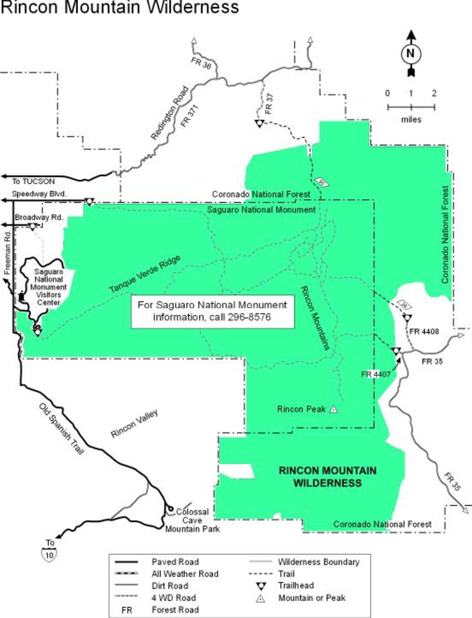
The 38,590-acre National Forest portion of the Rincon Mountain Wilderness borders Saguaro National Park on three sides and remains pleasantly remote in spite of its close proximity to Tucson. One reason for its seclusion is that, except for a few rough 4-wheel drive roads on the Wilderness’ northwest side and some trails leading into it from the Park, access is limited to two trails off the Mescal Road (Forest Road 35) on the area’s eastern side. This road, which leads through the communities of Mescal and Happy Valley, is generally passable to passenger vehicles. The Rincon Mountain Wilderness is rugged and steep with many deep canyons and rocky ridges. Portions of the area are difficult to reach on foot and virtually impassable on horseback. Miller Creek Trail is closed to horses in the Park. Elevations range between 3,880 and 7,325 feet in the Forest, reaching 8,482 feet at the summit of Rincon Peak in the Park. Settings on the Forest range from desert grassland to pinyon, juniper, and oak woodlands. Trails into the Wilderness offer quality opportunities for solitude among the area’s secluded canyons and remote ridges. Both Turkey and Miller Creeks are good examples of desert riparian habitats. The trails that lead into these areas continue on into the Saguaro National Park and link up with an extensive trail system there.
To Turkey and Miller Creek trails, drive east 39 miles from Tucson on I-10 to the Mescal road exit (#297). Drive north on the Mescal Road which becomes FR-35 to the trailheads (16 miles). To Italian Spring Trail, take Tanque Verde road east. The road changes to Redington Pass Road; continue east for approximately 8 miles. Turn south on FR-37 (4-wheel drive).
Content from Rincon Wilderness web site