Glacier Ridge Metro Park

Glacier Ridge Metro Park
9801 Hyland Croy Road Plain City, Ohio 43064
Official WebsiteGlacier Ridge Metro Park map
About this Location
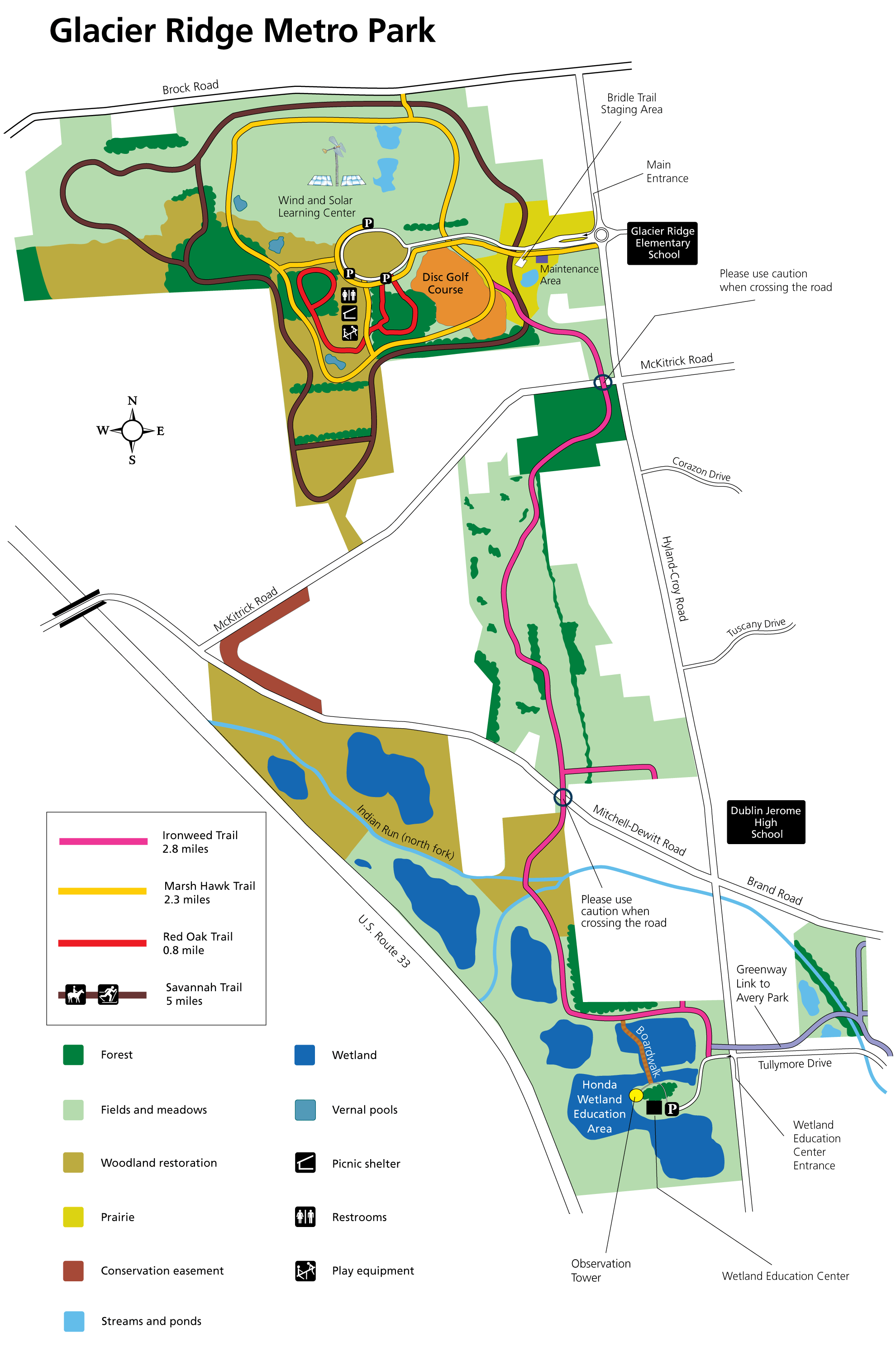
Glacier Ridge was named for the end moraine or glacial debris left behind when the glaciers retreated some 12,000 to 17,000 years ago. Much of the 1,037-acre park was once covered with farmland. Visitors can traverse a boardwalk through the Honda Wetlands Area or climb a 25-foot observation tower to see waterfowl and other animals.
Notable Trails
Glacier Ridge Metro Park Trails
Glacier Ridge Metro Park has over 11 miles of trails for hiking. Please use the hotspot which is appropriate to the trail you hike when you submit a bird checklist or use the general hotspot for the whole park if you are reporting a list of birds from several locations within the park.
There are three trails in the north section of the park:
Marsh Hawk Trail – 2.3 miles
Red Oak Trail – 0.8 miles
Savannah Trail – 5 miles
The Ironweed Trail, 2.8 miles, 5.6 miles out and back, runs north and south in the park.
A description and map of a hike using the Marsh Hawk Trail are available on the AllTrails website.
Features
Restrooms on site
Content from Official Website